 vesseltracker.com
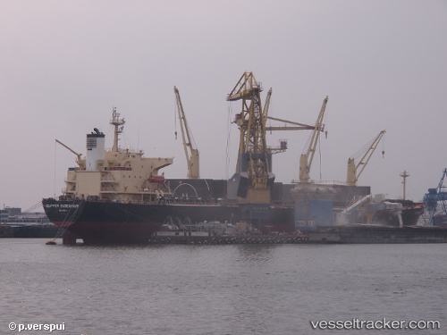
Vessel BAODA 17 IMO: 9274458, MMSI: 352986127 Bulk Carrier
UTC, 36.08865, 120.31539, course: 103, speed: 0
UTC, 36.08867, 120.31537, course: 103, speed: 0
2026-02-09 05:44:40 UTC, 36.08866, 120.31537, course: 103, speed: 0
Live AIS position:
UTC. Near Qingdao),
updated 2026-02-09 05:44:40 UTC.
Find the position of the vessel BAODA 17 on the map. The latter are known coordinates and path.
marine traffic ship tracker show on live map
The current position of vessel BAODA 17 is 36.08866 lat / 120.31537 lng. Updated: 2026-02-09 05:44:40 UTCCurrently sailing under the flag of Panama
BAODA 17 built in 2004 year
Deadweight:
52483 tDetails:
Last coordinates of the vessel:
UTC, 36.08866, 120.31538, course: 103, speed: 0UTC, 36.08865, 120.31539, course: 103, speed: 0
UTC, 36.08867, 120.31537, course: 103, speed: 0
2026-02-09 05:44:40 UTC, 36.08866, 120.31537, course: 103, speed: 0